caso-de-estudio-flood
Take the following recommendations into account:
On this page, you will find a description of the elements used to build a case study for the Flood Mitigation Module, which you may use as an example. Remember that a case study in this module begins with the definition of a watershed, on which the system will assess the effect of Nature-Based Solutions (NbS) in reducing flood damages. Below, we explain why:

- WaterProof relies on the geographic delineation of a watershed to simulate rainfall effects and analyze how NbS can modify water dynamics on the terrain, reducing the depth, velocity, and extent of floods.
In this module, the avoided damages are considered across different land uses, such as residential, agricultural, industrial, or road infrastructure areas. - The analysis allows estimating the hydrological and economic benefits derived from the implementation of NbS, showing how these solutions contribute to mitigating risks and reducing losses caused by flood events.
Please follow the following steps:


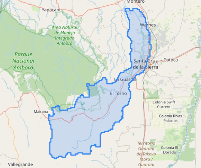
Example case
The example provided is based on the watershed of the Piraí River in the city of Santa Cruz de la Sierra, Bolivia. Approximately 1,610,982 people live there, with an economy based on agribusiness, manufacturing, construction, commerce, and the financial sector, making it a leader in food production and non-traditional agricultural exports.